


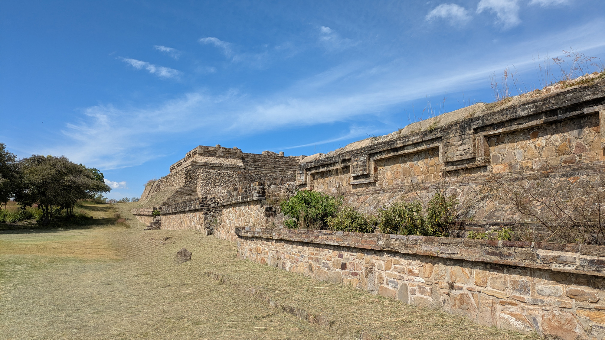
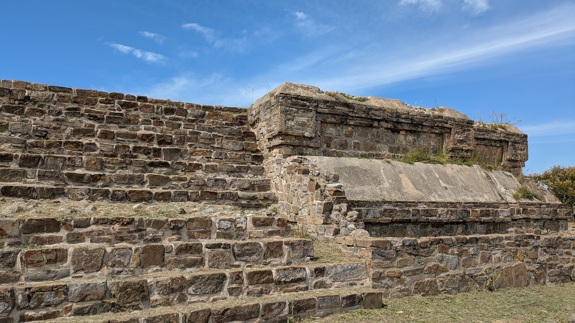
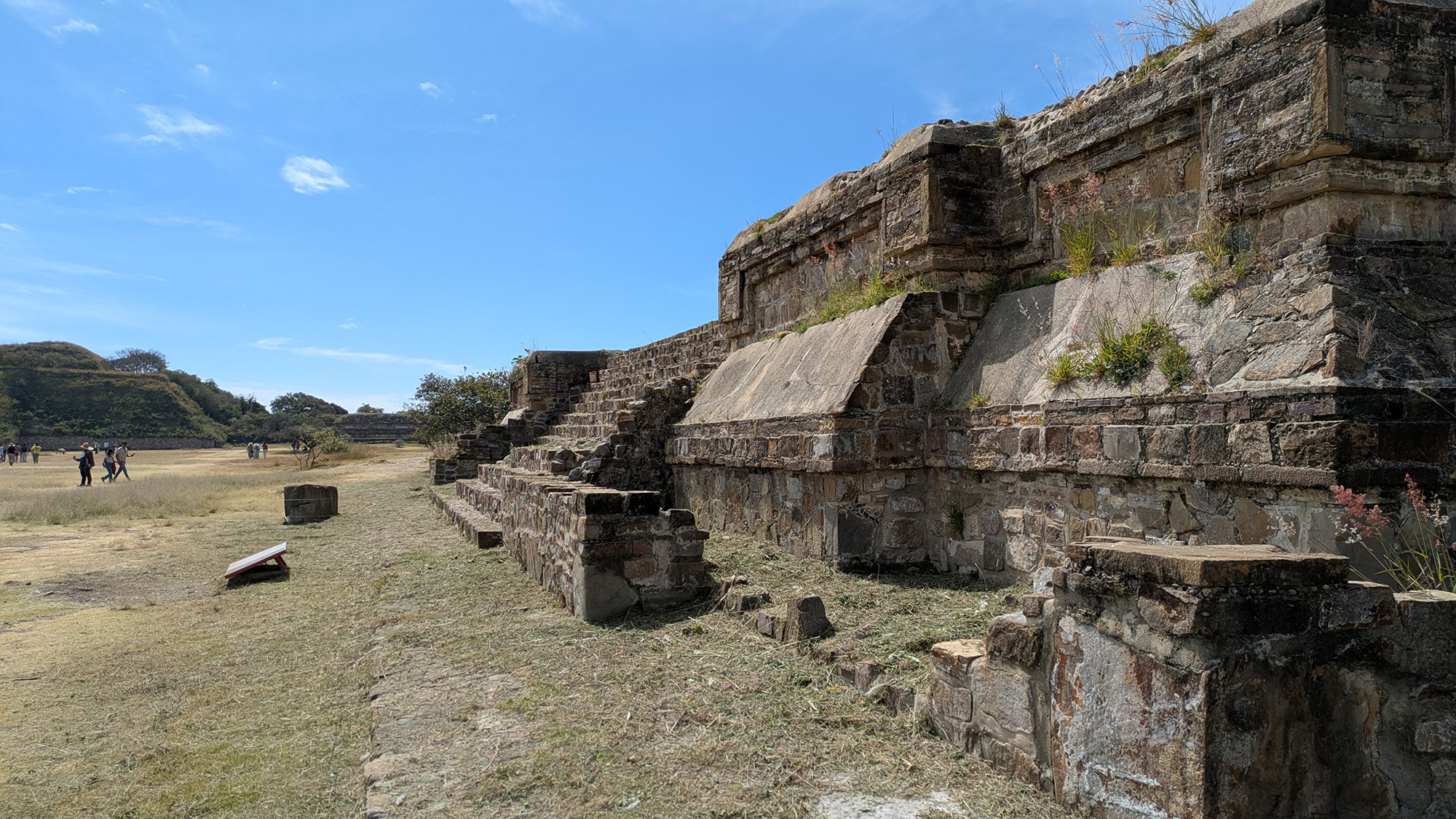
The architectural complex known as System IV, situated at the northwest perimeter of the Main Plaza of Monte Albán, represents one of the most significant manifestations of Zapotec state formation and institutionalized ritual behavior in ancient Mesoamerica. As a primary component of the city’s monumental core, System IV serves as a definitive example of the "Temple-Patio-Altar" (TPA) arrangement. This complex is an integrated ceremonial machine designed to facilitate restricted ritual access, solar observation, and the display of elite authority within a highly structured urban environment.1
Spatiotemporal and Geospatial Context
Monte Albán is strategically positioned atop a low mountain range at the nexus of the three primary arms of the Valley of Oaxaca: the northern Etla branch, the eastern Tlacolula branch, and the southern Zimatlán-Ocotlán (Valle Grande) branch. The central location provided the Zapotec elite with an unparalleled vantage point from which to monitor activity throughout the valley floor, roughly 400 meters below the ridge.3 The elevation of System IV (1,940m ASL) places it within a unique microclimate characterized by high solar visibility and clear horizons—factors instrumental in the development of the site's archaeoastronomical programs. Modern navigational and cartographic studies indicate a magnetic declination of -4.61° (West) as of 2021. These variables are essential for ongoing geophysical prospection, such as the Proyecto Geofísico de Monte Albán (PGMA), which has recently revealed buried structures beneath the plaza surface that predate the current Classic facade.Taxonomy and the Evolution of the "System" Designation
The terminology of "Systems" at Monte Albán acknowledges these complexes as "ceremonial ensembles" rather than discrete buildings. A "System" follows a specific spatial logic: a transition from open, public space to restricted, elite-controlled ceremonial space. System IV meticulously follows this layout, consisting of a front platform, an enclosed sunken courtyard, a central altar (adoratorio), and a dominant rear temple platform (Building K). Access to this patio was strictly controlled; the "blind entrance" (entrada ciega) and narrow corridors ensured that activities within were secluded from the broader public gathering in the Main Plaza.2| Phase | Dates | Developmental Milestones |
|---|---|---|
| Monte Albán I | 500 - 100 BCE | Foundation of the site; construction of megalithic walls beneath System IV. |
| Monte Albán II | 100 BCE - 200 CE | Urban expansion; initial "System" layout; erection of Stela 18. |
| Monte Albán III | 200 - 800 CE | Urban apogee; peak of the "double scapular" style on the facade. |
| Monte Albán IV/V | 800 - 1521 CE | Decline of central authority; Postclassic Mixtec ceremonial reuse. |
Archaeoastronomy: The Role of Stela 18
Standing adjacent to the north wall is Stela 18, a monolithic column reaching 5.8 meters (19 feet). Its primary function was that of a gnomon—a shadow-caster used to verify midday and mark the solstices. At the latitude of Monte Albán (17.04° N), the sun passes the zenith twice annually (May and August), casting no lateral shadow. This verification allowed the priesthood to maintain accurate timekeeping for agricultural and ceremonial cycles. Epigraphic analysis by Joyce Marcus demonstrates that these glyphs also served as "horizontal propaganda," utilizing genealogical registers to legitimize the rule of noble families.15Subterranean Infrastructure and "Staged Invisibility"
A hallmark of System IV is its use of subterranean "subways" or tunnels. Originally excavated by Alfonso Caso, these served two primary functions:- Theatrical Ritual Movement: The tunnels allowed high-status individuals to move discreetly between platforms, facilitating "staged invisibility" where they could appear or disappear suddenly during public ceremonies to project supernatural authority.
- Hydrological Engineering: The tunnels were integrated into a sophisticated drainage system. Terracotta channels conducted heavy rainfall away from the platforms, preserving the structural stability of the massive masonry against the region's high seismicity.6
Symmetry and Duality: System IV vs. System M
The urban layout exhibits a remarkable degree of symmetry; System IV (Northwest) is mirrored by System M (Southwest). This architectural mirroring—often referred to as "duality"—likely reflects Zapotec governance where political power was balanced between moieties. While the form is nearly identical, their associations differ: System IV is anchored to the astronomical gnomon (Stela 18), while System M is linked to the historically charged Building L (Danzantes).Recent Investigations and 3D Documentation
Modern research led by the PGMA has revealed at least three major buried structures beneath the plaza floor dating to the Danibaan phase (500 BCE). Additionally, a pilot project by CyArk produced a high-definition 3D point cloud of System IV consisting of over 415 million measurements. This record is critical for monitoring structural cracks following the devastating Mw 8.2 earthquake of 2017.7Scholarly References & Primary Sources
- Marcus, Joyce, and Kent V. Flannery. (1996). Zapotec Civilization. Thames & Hudson.
- INAH. "Monte Albán - Lugares INAH."
- Peeler, David A., and Marcus Winter. "Building J at Monte Albán..." 1995.
- Levine, Marc N., et al. "Monte Albán’s Hidden Past." 2021.
- Montero, Arturo. "Orientaciones Astronómicas."
- Alcántara, S., et al. "Ground Motion at the World Heritage Archaeological Site of Monte Albán, Oaxaca, Mexico during Recent Damaging Earthquakes." Geofísica Internacional, 2026 (Institutional Revision).
- CyArk / Open Heritage 3D. "Data Sets: Monte Albán 3D Documentation Project."