


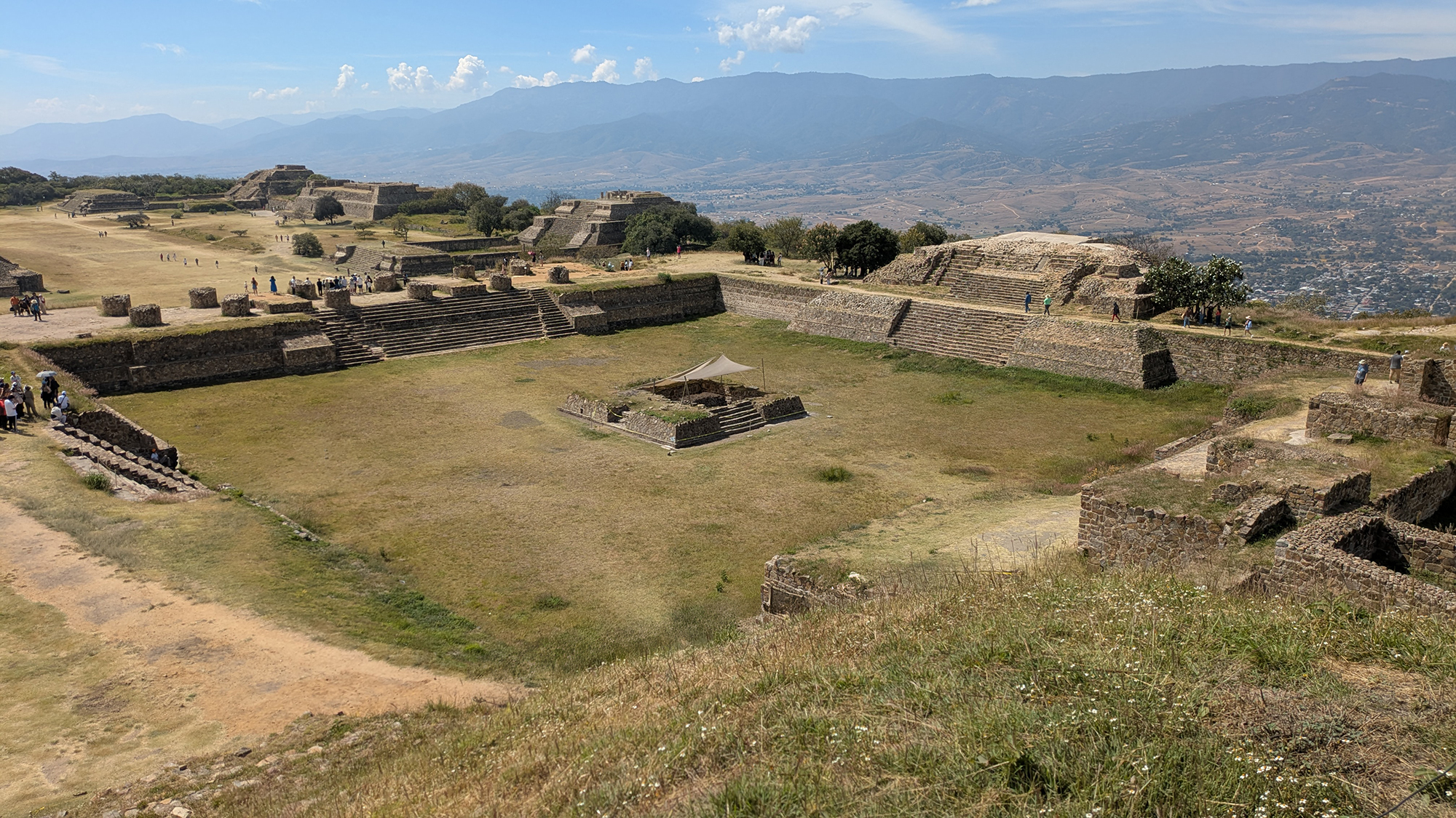
The North Platform represents the most sophisticated and monumental expression of elite residential and ceremonial architecture in the Zapotec capital. Serving as an axis mundi—a symbolic "mountain of creation"—this massive basal complex was designed to mediate between the public theater of the plaza and the restricted, sacred domains of the ruling elite. Its evolution reflects the broader trajectory of the Zapotec state: increasing social stratification, the institutionalization of ancestor worship, and the sophisticated integration of astronomical and calendrical cycles into the built environment.4
Geopolitical and Environmental Context
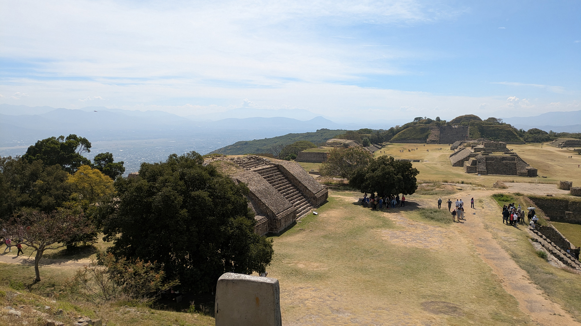
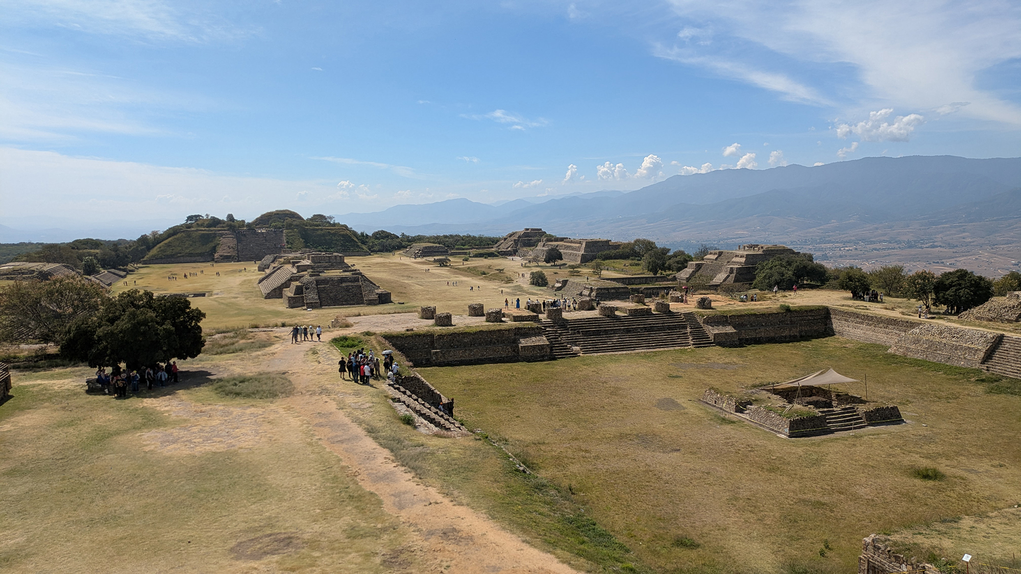
Monte Albán sits at the geographic convergence of the Valley of Oaxaca’s Etla (North), Tlacolula (East), and Zimatlán (South) branches. The North Platform, occupying the central ridge's highest shelf, functioned as a manifestation of social distance. The platform's controlled access filtered movement, effectively "heading" the sacred topography of the city.2Archaeological Genesis: Buried Structures
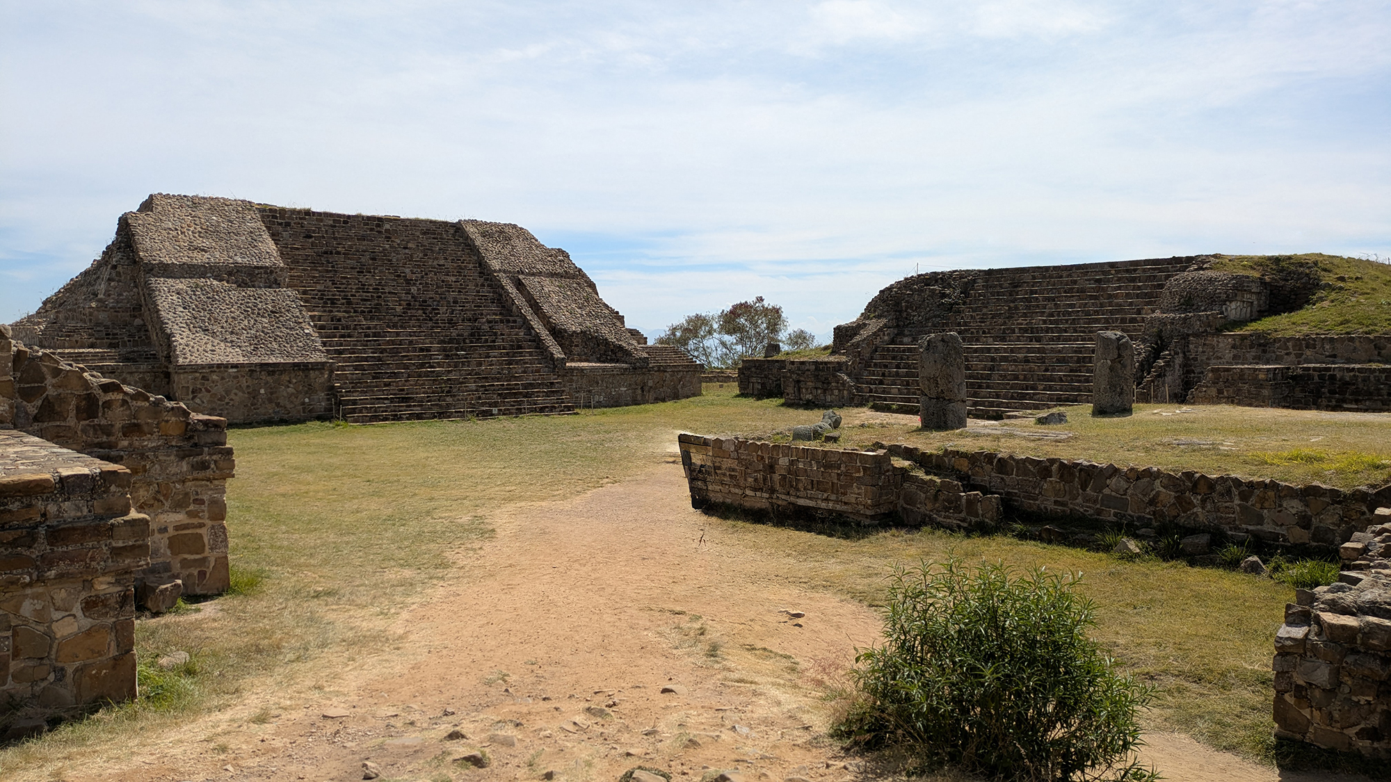
Recent surveys by the PGMA (Proyecto Geofísico de Monte Albán) using GPR and electrical resistance have identified three buried structures beneath the current foundations dating to the Danibaan (500-300 BCE) and Pe phases. The discovery of an 18x18 m temple razed during the Nisa phase renovation indicates a period of "creative destruction," where older symbols were decommissioned to make way for the Classic period acropolis.4Engineering the Sacred: The Great Staircase and Stela 9
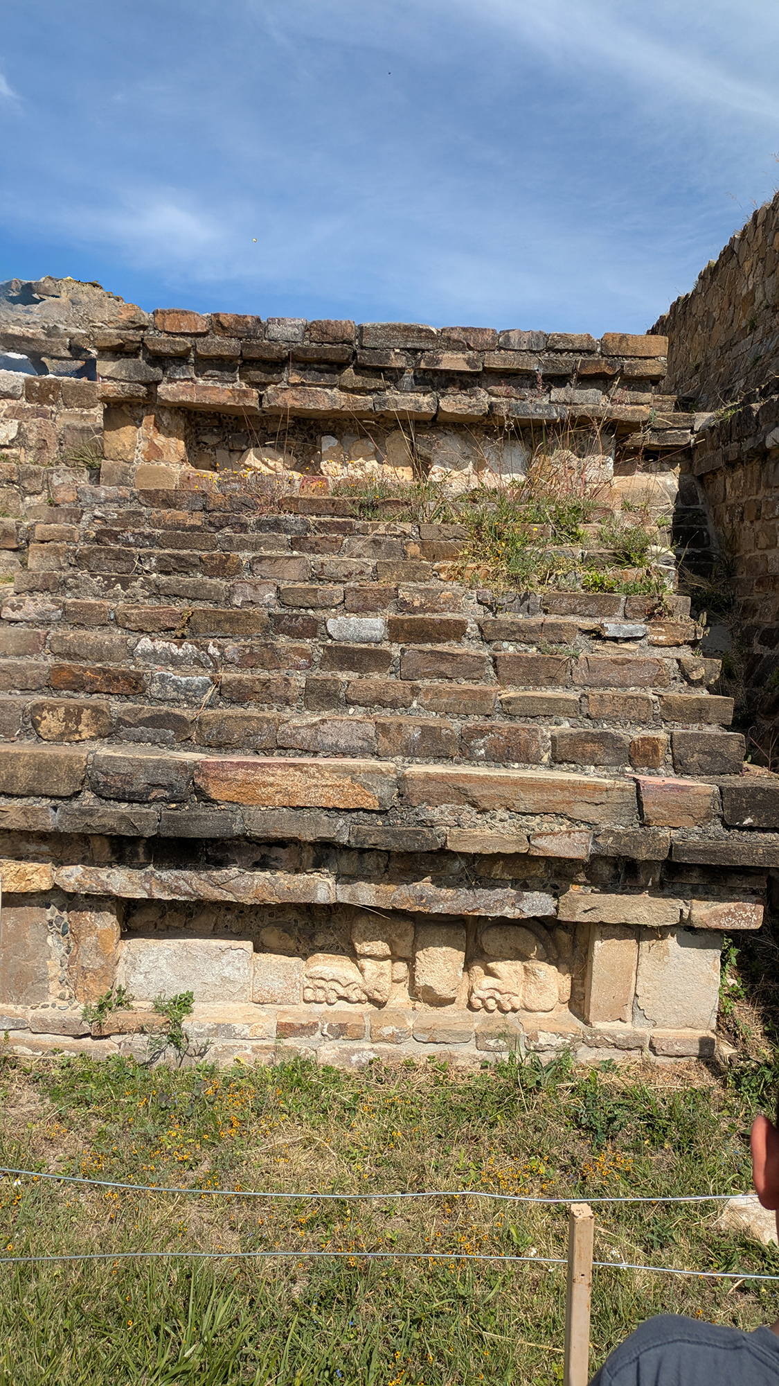
The Great Staircase serves as the critical interface between the plaza and the elite precinct. Flanked by wide alfardas featuring the Zapotec double scapular panel, the staircase ritualized ascent "toward the clouds." At its base, Stela 9 (discovered 1902) features Mayan-style hieroglyphs, providing a public record of the lineage and conquests of the elite who occupied the summit.6| Feature | Description |
|---|---|
| Great Staircase | Monumental access; central ritual filter between public and elite space. |
| Stela 9 | Monolithic "obelisk"; records elite political and ritual obligations. |
| Rounded Corners | High walls incorporating natural rock; atypical in Mesoamerican urbanism. |
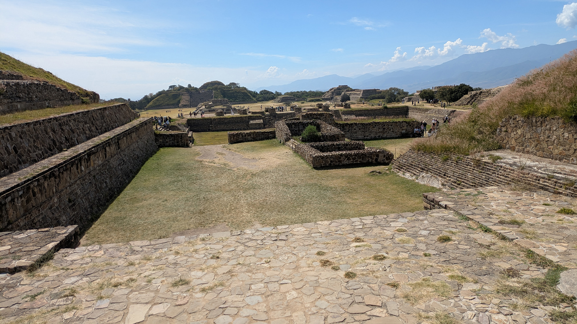
The Sunken Patio (Patio Hundido): Arena of Power
Measuring 50x50 m and 3 m deep, the Sunken Patio complemented the surrounding temples. At its center stands a 12x12 m adoratorio (altar) for sacrifice.Acoustics and "Subways"
Acoustic design within the patio amplified ritual chants for those within the enclosure. Excavations also revealed subterranean "subways" or tunnels, allowing priests to move discreetly and emerge suddenly atop temples, creating a sense of divine manifestation.58Geospatial Placement
The Architecture of Exclusion: VG Complex
The Vértice Geodésico (VG) complex represents the city's most exclusive environment. It consists of four structures forming a quadrangle: Building VG (East), D (North), E (South), and the Temple of the Two Columns (West).The Celestial Clock
Building VG served as an observation point for sunset alignments on April 11 and September 1, aligned perfectly with the Temple of the Two Columns. These dates regulated the Zapotec agricultural and ritual calendars. The Temple of the Two Columns features massive 2-meter diameter pillars that once supported a 6-meter high roof, emphasizing the scale of the summit precinct.5Residential Dialectics: The Palatial Compounds
Luxurious multi-room palaces served as private homes and administrative hubs. Habitational rooms were consistently located on the North side of the courtyard, while South rooms handled public matters.Hydraulics and Impluviums
Sophisticated drainage systems utilized roof impluviums to channel rainwater into stone-lined cisterns and tunnels, reinforcing the elite's role as managers of the life-giving rain.12Ancestral Memory: Tombs 104 and 105
Elaborate masonry tombs were built beneath the patio floors of residential compounds.- Tomb 104 (The Painted Codex): Features a Cocijo urn and murals of a processional journey toward the "Jaws of the Sky" celestial portal.7
- Tomb 105 (Procession of Elders): Depicts 18 attired individuals, many without teeth to signify advanced age and venerable elder status, serving as a visual genealogy of the noble lineage.8
Decline and Re-Territorialization
After the city's collapse (c. AD 800), the nobility was "deterritorialized." However, the platform remained sacred; commoners from the valley returned for centuries to leave miniature vessels and incense burners. The Mixtecs later utilized the site as a necropolis, most famously in the reuse of a Zapotec tomb for Tomb 7, containing over 600 gold and jade objects.2Scholarly References & Primary Sources
- INAH. "Monte Albán - Lugares INAH."
- UNESCO. "Historic Centre of Oaxaca and Monte Albán."
- Met Museum. "Monte Albán Royal Tombs and Murals."
- Marcus & Flannery. (1996). Zapotec Civilization. Thames & Hudson.
- INAH Mediateca. "Patio Hundido Technical Data."
- Met Museum. "Stone Sculpture Program."
- Urcid, J. "Zapotec Hieroglyphic Writing." 2001.
- INAH. "Structure Group: Sunken Patio."
- INAH. "Juego de Pelota (Ballcourt)."
- FAMSI. "Cocijo Effigy Vessels (Tomb 104)."
- Alcántara, S., et al. "Ground Motion at Monte Albán (Spectral Amplification)." 2026.
- Urcid, J. "House of Tomb 103 Isometric."
