Oaxaca to Puerto Escondido Highway Update After Hurricane Erick
Hurricane Erick’s Impact on Oaxaca’s Coastal Highways (June 2025)
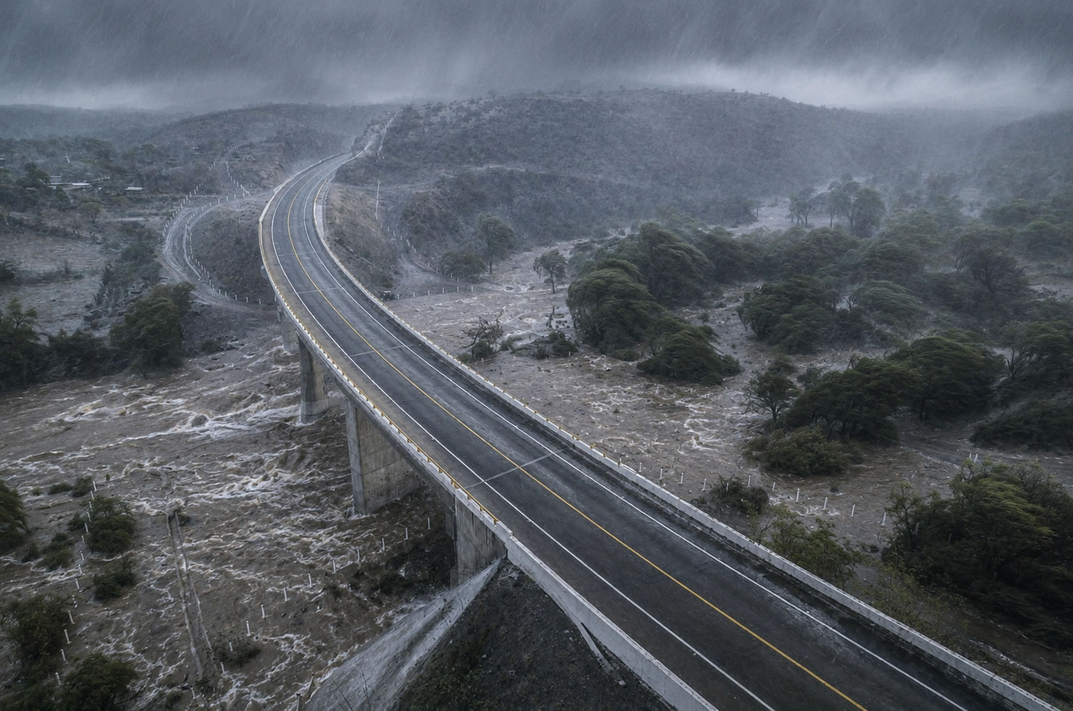
Hurricane Erick made landfall as a Category 3 storm early on June 19, 2025, near the western Oaxaca coast close to Puerto Escondido. The storm brought intense rainfall, strong winds, and triggered numerous landslides across the mountainous terrain between the Valles Centrales and the Pacific coast.
Official reports from the Gobierno del Estado de Oaxaca and Protección Civil confirmed significant disruption to the main highway links between Oaxaca City and the Costa region, particularly the supercarretera Barranca Larga–Ventanilla (the modern toll road) and sections of the older federal highway 175/200 routes.
Specific Road Closures and Damage Reported
According to the official June 20, 2025 update from the state government:
- Supercarretera Barranca Larga–Ventanilla (Oaxaca–Puerto Escondido): Intermittent single-lane passage due to landslides at km 62–63 and km 71–73. Multiple derrumbes (landslides) required ongoing clearing.
- Oaxaca–Puerto Escondido highway: Total closure at km 142+500 and km 146. Partial closure reported at km 208.
- Additional affected routes included sections of the Pinotepa Nacional–Salina Cruz highway (total closure at km 142+550), San Mateo Río Hondo–Puerto Ángel (km 182 and 186), and various points on federal highway 200.
Power outages affected over 120,000 customers in Oaxaca at peak, and fallen trees, debris, and flooding compounded road access issues, especially in the Costa Chica and around Puerto Escondido.
Recovery Efforts and Current Status (Post-Erick)
State and federal agencies (including SEDENA, Guardia Nacional, and SICT) immediately activated emergency response plans (Plan DN-III-E and Plan AVE) to clear debris and restore traffic.
- By June 20, 2025, crews had cleared fallen trees and branches along the Puerto Escondido–Pinotepa Nacional corridor (83 obstructions removed).
- Paths from San José del Pacífico to Pochutla were reopened for free transit.
- Some sections of federal highway 190 and local routes were restored the same day.
- The Barranca Larga–Ventanilla supercarretera operated with intermittent/single-lane traffic while major landslides were addressed.
As of mid-2026, the supercarretera Oaxaca–Puerto Escondido (Barranca Larga–Ventanilla) is fully operational under normal conditions. However, like many mountain highways in Oaxaca, it remains susceptible to seasonal landslides during heavy rains. Travelers should always check current conditions before departing.
Travel Recommendations
If you are planning a trip from Oaxaca City to Puerto Escondido or the coast:
- Check official updates on oaxaca.gob.mx or Protección Civil Oaxaca before traveling.
- Use navigation apps with real-time traffic alerts.
- Allow extra time — even on clear days, mountain roads can have temporary restrictions.
- Consider the supercarretera Barranca Larga–Ventanilla for the fastest and safest route when fully open (typically 2.5–3 hours vs. 5–6+ hours on older roads).
- Have a backup plan (e.g., overnight in a midpoint town) during the rainy season (June–October).
Combining Your Coastal Trip with Monte Albán
Many visitors combine a coastal stay in Puerto Escondido with time in the Valles Centrales and Monte Albán. With the highway now fully functional post-Erick, the journey is straightforward again. Download our free Monte Albán audio tour and printable map in advance so your archaeological visit is as rewarding as your beach time.


