


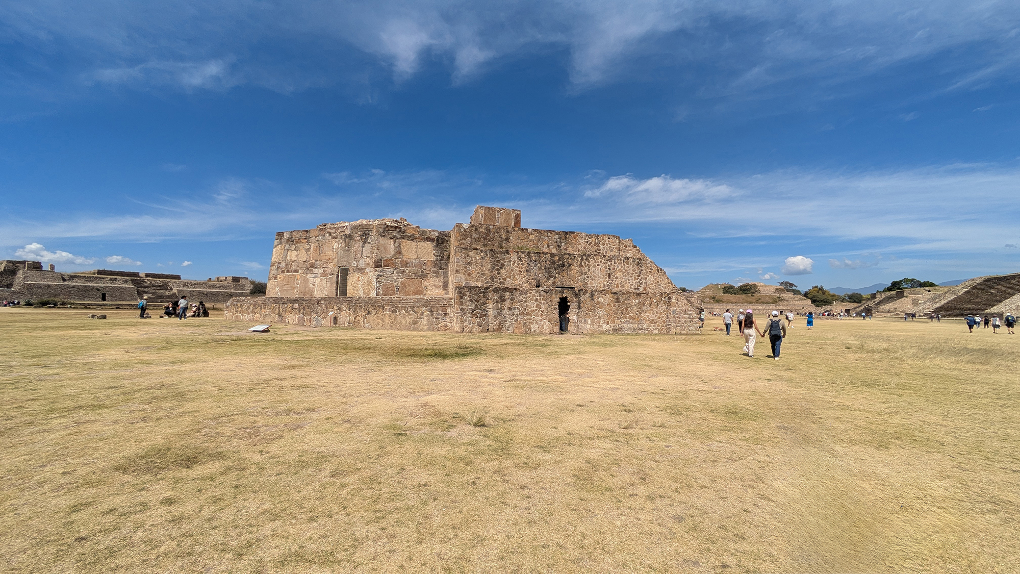
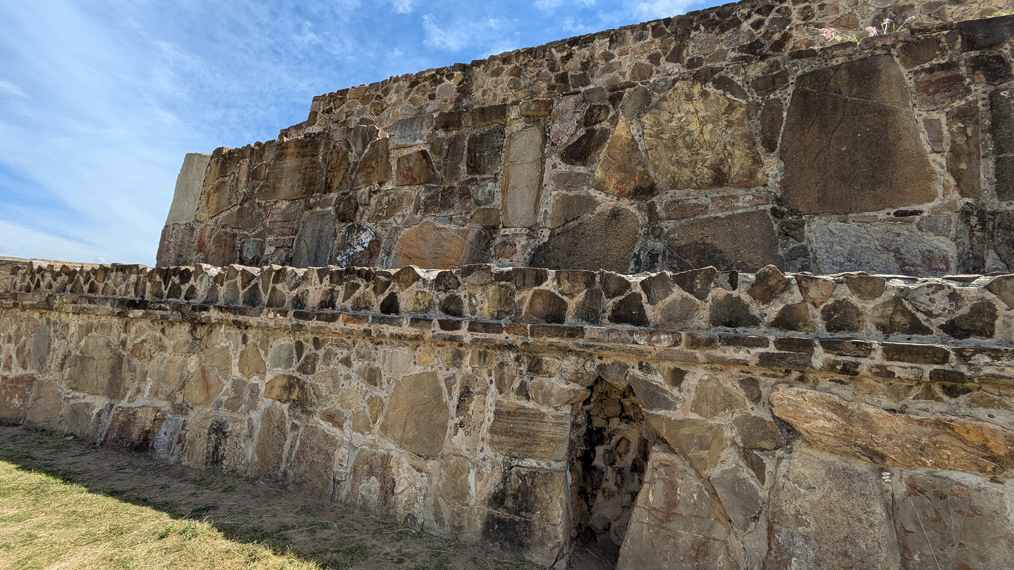
Building J (El Observatorio) is arguably the most famous and architecturally unique structure at Monte Albán. Located on the central spine of the Main Plaza, just north of the South Platform, it breaks the city's strict cardinal grid with its pentagonal, "arrowhead-shaped" plan. Constructed during the Monte Albán II phase (approx. 100 BCE – 200 CE), it served as a dual-purpose monument: a sophisticated astronomical observatory and a permanent stone record of the Zapotec state's military expansion.1
Architectural Features and Orientation
Internal Infrastructure: The Star Tube
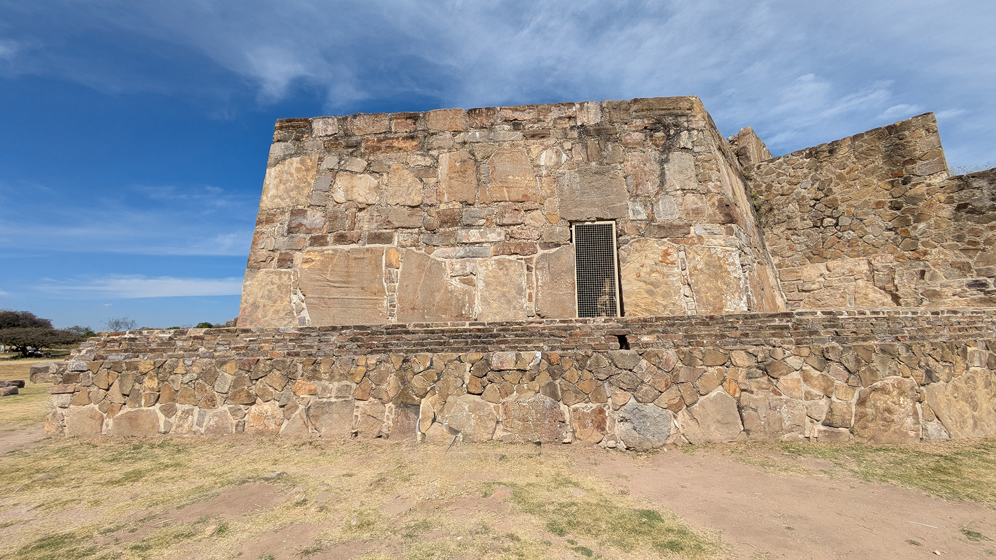
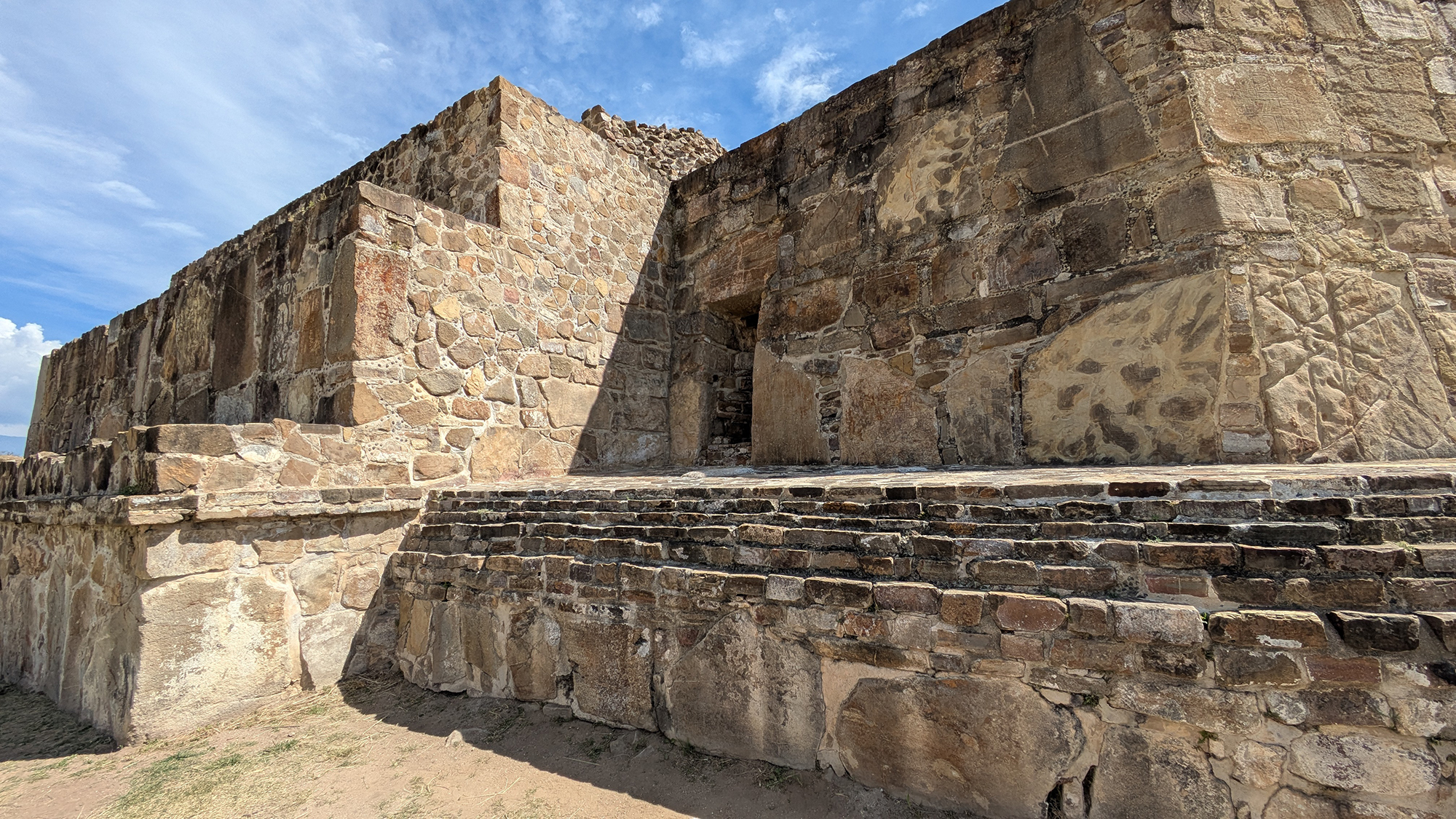
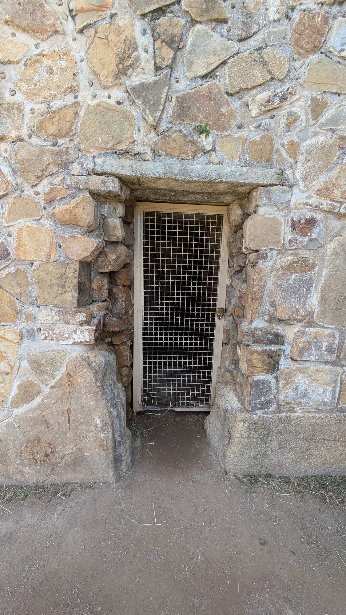
The structure is crossed by a long, narrow, and vaulted subterranean corridor. Early accounts from 1806 by Luciano Castañeda and Guillermo Dupaix described the base as having four entrances that crossed in the center, leading to a vertical "tube" or light-well. Modern researchers believe this tube allowed the Zapotecs to observe the sun when it was directly overhead (the Zenith), casting no shadows on the ground.²The Conquest Slabs: State Propaganda in Stone
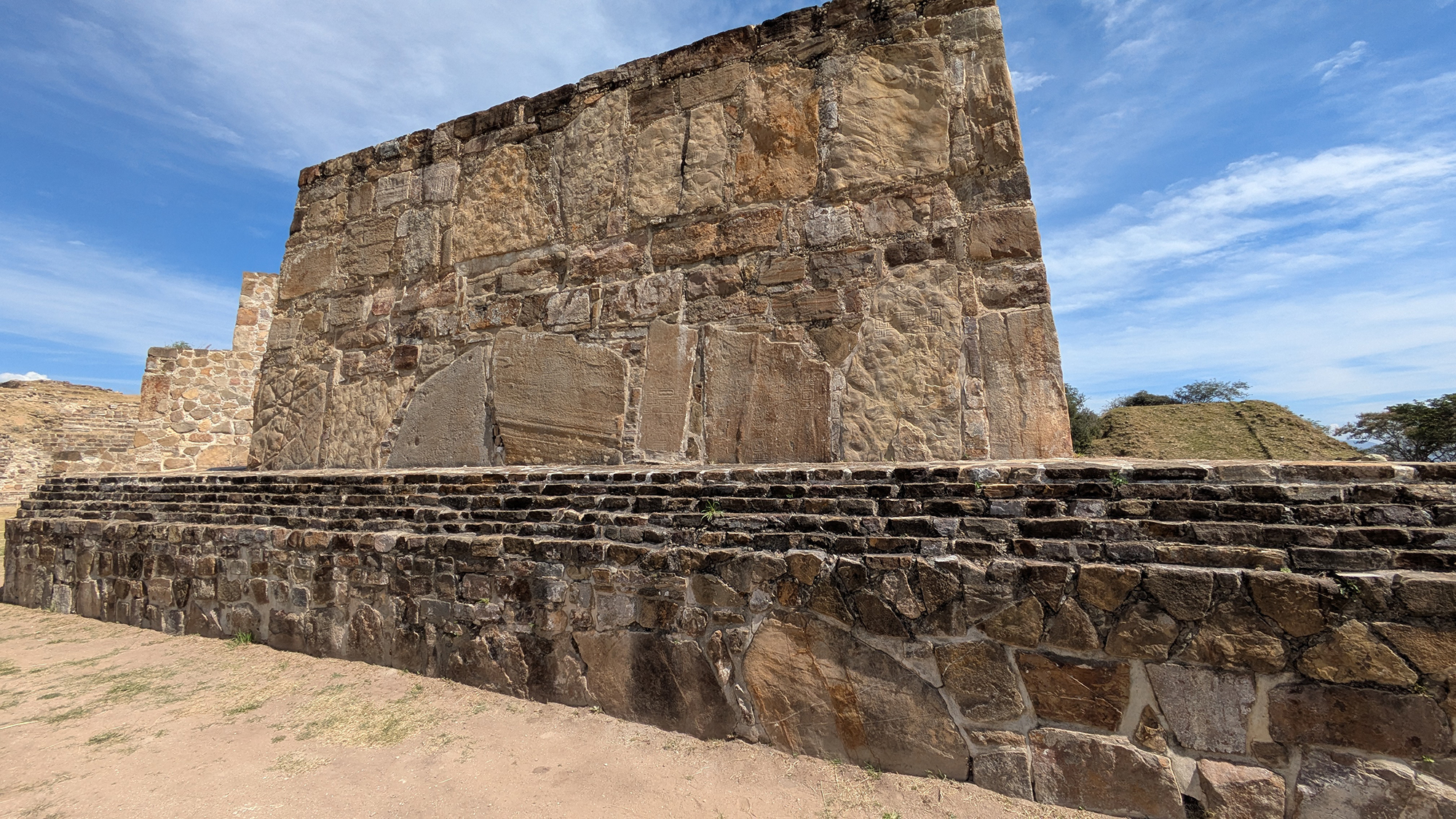
The exterior walls of Building J are encased with approximately 40 to 50 inscribed stone slabs. These function as a form of state propaganda, advertising the Zapotec state's dominion over rival groups. Think of these as permanent historical records meant to intimidate visitors and celebrate the Zapotec military.⁴Deciphering the Narrative
A standard Period II conquest slab typically contains three distinct elements that tell a story of defeat:- The Upside-Down Head: A standard Mesoamerican convention representing a defeated or sacrificed local ruler.
- The "Hill" Glyph (dàni): A general sign for "place" or "territory."
- The Toponym: A specific identifying glyph placed above the hill to name the conquered region.
Identified Territories
Archaeological surveys, notably the Cuicatlán Cañada Project, have confirmed that these glyphs represent actual expansion into neighboring valleys.⁵ Identified regions include:- Cuicatlán: "The Place of Song"
- Chiltepec: "The Hill of Chili"
- Ocelotepec: "The Hill of the Jaguar"
- Sosola: "The Place of the Pierced Face"
Archaeoastronomy: The "73-Day Family"
In 1972, Aveni & Linsley argued that Building J pointed directly to the heliacal rising of Capella (the brightest star in the constellation Auriga). This was the "starting gun" for the Zapotec calendar, marking the first day the sun passed directly overhead (the zenith).6 Recent research (2025) conducted by Aarón Uriel González Benítez, in collaboration with INAH and SECTUR, has refined our understanding of the building's solar orientation. The project documented that the axis of symmetry of Building J aligns precisely with the sunset on September 1 and April 11. These dates are critical components of the "73-day family," a mathematical cycle that allowed the Zapotecs to divide the year into five perfect blocks ($5 \times 73 = 365$), effectively integrating the architecture into the Zapotec calendrical system.7Modern Research and Subsurface Findings
The PGMA Project: Directed by Marc Levine, this project used ground-penetrating radar to see "through" the stone. They detected Structure H4-1, an 18 x 18 m temple platform buried directly beneath Building J. This proves that the Zapotecs intentionally destroyed an older building just to make room for this specialized Observatory.⁹ Aerial LiDAR Survey (2022): While early photogrammetry focused on other sectors of the plaza, a comprehensive aerial LiDAR mapping survey was conducted in 2022 by a team led by Dr. Saburo Sugiyama. MAPSA is currently working to integrate and process this high-resolution topographical data to further map the subsurface relationships between Building J and the Main Plaza.¹⁰Visiting Notes
- Best View: Go to the South Platform for a "birds-eye" view of the arrowhead shape.
- Don't Miss: Lápida 15 at the base—it’s the most famous example of the conquest carvings.
- Pro Tip: Visit in the early morning. The low light creates long shadows that make the shallow carvings "pop" out of the stone.
Scholarly References
- Metropolitan Museum of Art. "Monte Albán: Sacred Architecture," 2001.
- Castañeda, L., & Dupaix, G. Antiquités Mexicaines, 1806 Expedition Records.
- Aveni, A. F., & Linsley, R. M. "Mound J, Monte Albán: Possible Astronomical Orientation." American Antiquity, 1972.
- Marcus, Joyce. "The Conquest Slabs of Building J." AMNH Research Series.
- Marcus, J., & Flannery, K. V. Zapotec Civilization, Thames & Hudson, 1996.
- Aveni & Linsley, 1972 (op. cit.).
- González Benítez, Aarón Uriel. "Investigación Arqueoastronómica del Edificio J: La Familia de los 73 días." Proyecto INAH/SECTUR, 2025.
- Peeler, D. E., & Winter, M. "Building J at Monte Albán: A Correction and Reassessment of the Astronomical Hypothesis." Latin American Antiquity, 1995.
- Levine, Marc N. "Monte Albán’s Hidden Past: Buried Buildings and Sociopolitical Transformation." Latin American Antiquity, 2021.
- CyArk Digital Archive. "Monte Albán 3D Documentation Project," 2024.
- Sugiyama, Saburo, et al. "New perspectives of Monte Alban-Atzompa complex through new LiDAR mapping survey." The Digital Archaeological Record (tDAR), 2022.