


Monte Albán is the most prominent pre-Columbian archaeological site in the Central Valleys of Oaxaca, a hilltop capital established by the Zapotecs and later used as a sacred necropolis by the Mixtecs. Recognized for its monumental urban planning, early writing systems, carved monuments, elite tombs, and commanding position above the valley’s three arms, it functioned not merely as a ceremonial center, but as a “planned mountain city,” an enduring symbol of authority that shaped the sociopolitical trajectory of the Oaxacan highlands for more than a millennium.
Although it is frequently described online as the “Sacred Mountain” or assigned a definitive original Zapotec name, the pre-Hispanic toponym is not known with certainty in the institutional record. A definitive reference archive must clearly distinguish between firm archaeological evidence and later labels or interpretations that remain uncertain.¹²
Location and Layout
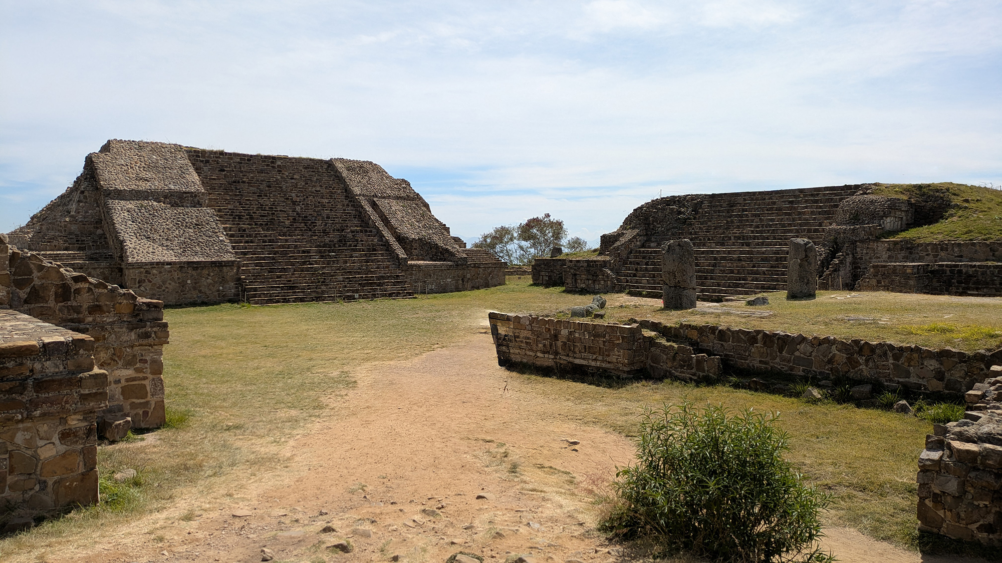
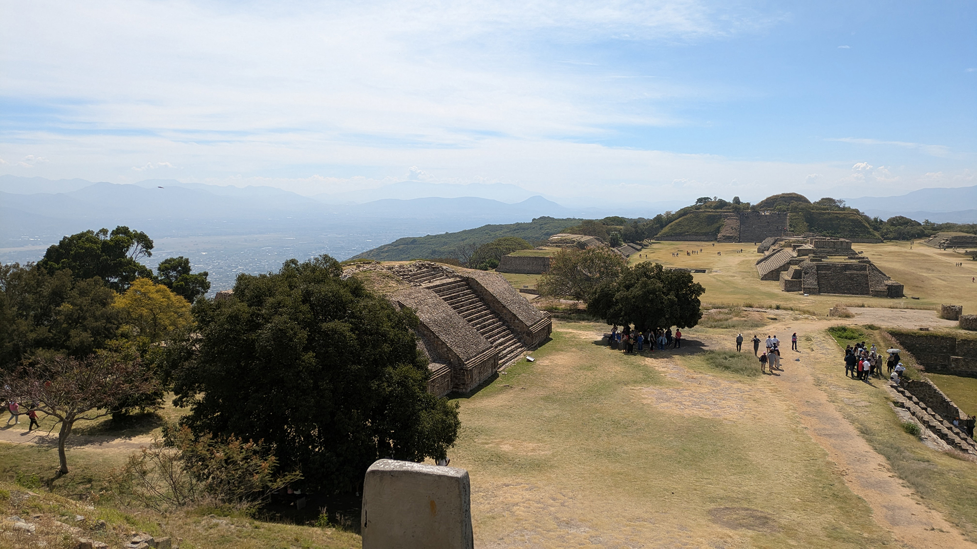
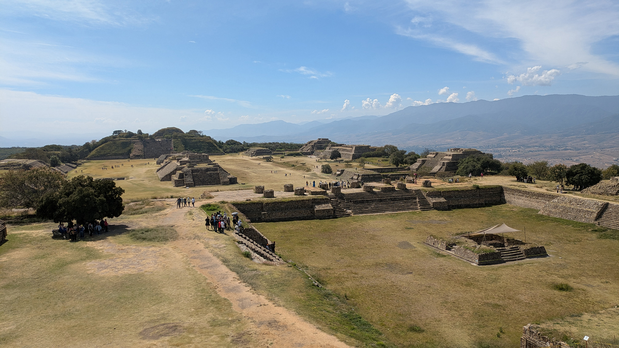
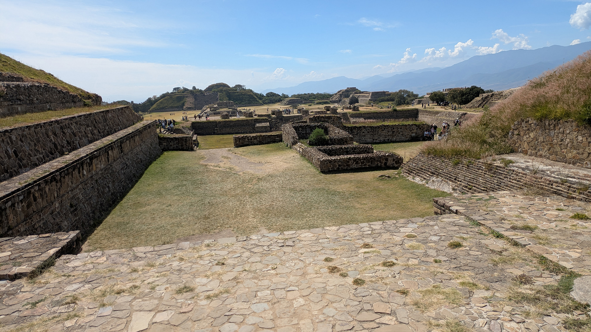
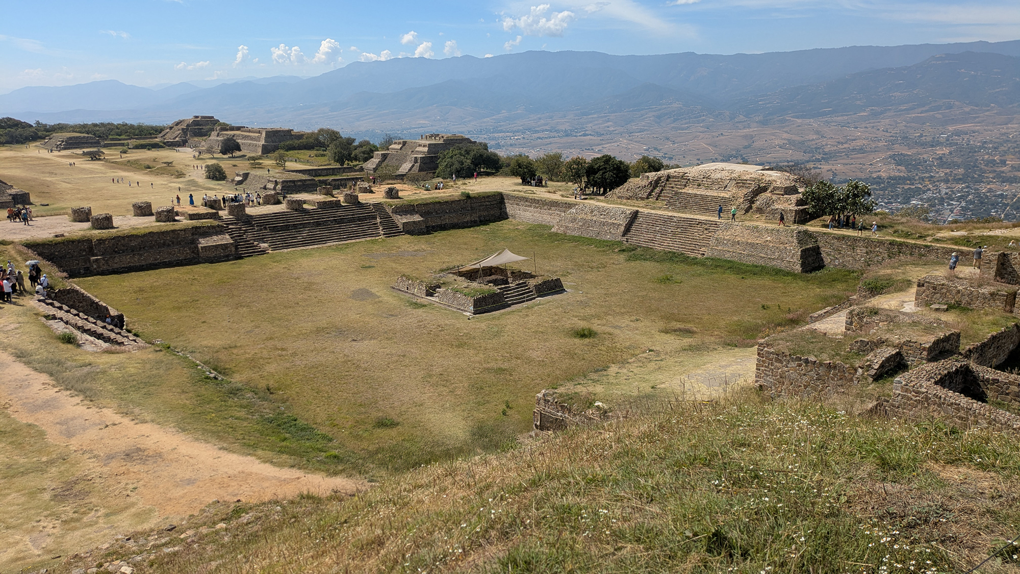
Monte Albán rises near the point where the three principal branches of the Valley of Oaxaca converge: the Etla, Tlacolula, and Zimatlán arms. Its placement was politically brilliant. From this elevated position, the city occupied a symbolic and strategic central location over the valley system, rather than being situated within a single preexisting community. Scholars such as Joyce Marcus and Kent Flannery have famously interpreted it as a “disembedded capital,” a new political center established on neutral ground to unify or dominate the competing interests of the valleys.¹ The monumental core is organized around the Main Plaza, a large leveled esplanade approximately 300 meters long by 200 meters wide. This was not a natural flat space; it was created through a massive program of cutting, filling, retaining, and leveling. The Main Plaza is flanked by the North Platform and the South Platform, while a series of central buildings, altars, stairways, and subsidiary structures create a ceremonial and political axis that guided movement, display, and visibility.²⁴ Beyond the central precinct, Monte Albán was a considerably larger urban settlement. Richard Blanton’s settlement-pattern work demonstrated that the expanded architectural zone covered approximately 6.5 square kilometers and included more than two thousand terraces, most of them residential. This fact changes our understanding of the site: Monte Albán was not merely a ceremonial center occasionally visited by neighboring populations; it was a permanent city with inhabitants distributed across terraced slopes.⁴¹⁰ UNESCO’s description reinforces this broader reading by emphasizing not only the pyramids and plazas, but also the terraces, dams, canals, and artificial mounds carved into the mountain as part of a sacred and engineered landscape. In other words, the mountain itself became architecture.²¹¹Chronological Phases and Development
The city’s evolution is divided into distinct archaeological phases, marking its transition from a local center to a regional empire.| Phase | Time Period | Key Urban Developments |
|---|---|---|
| Monte Albán I | c. 500 – 100 BCE | Foundation. Use of carved monuments (Danzantes) to project political power and establish a public visual language.⁷ |
| Monte Albán II | c. 100 BCE – 200 CE | Expansion as a regional state. The conquest slabs (Building J) record regional domination.² |
| Monte Albán III | c. 200 – 800 CE | Classic apogee. Peak population of ~35,000. Maturity of elite tombs and palace architecture.⁶ |
| Monte Albán IV–V | c. 800 – 1521 CE | Postclassic reorganization. Prestige endured, but power shifted. Mixtec reuse of Zapotec tombs, for example Tomb 7.¹⁶ |
Origins and Foundation
Before the rise of Monte Albán, the Valley of Oaxaca contained early centers such as San José Mogote. Around 500 BCE, part of the population moved to the new hilltop center. This relocation was remarkable because Monte Albán was not founded at the core of a long-established settlement, but on a mountain ridge that had to be physically transformed into an urban seat of power. Its origin story therefore occupies a central place in debates on early state formation in Mesoamerica.¹⁹Monte Albán I
The early phase involved the foundation of the city and the creation of its first civic-ceremonial spaces. During this period, rulers began using carved stone monuments, including the famous Danzantes reliefs, to project political power, record individuals or events, and establish a public visual language associated with government, conflict, and legitimacy.¹⁷¹³Monte Albán II
In Phase II, Monte Albán expanded as a regional state. Monumental construction intensified, the urban core was consolidated, and conquest slabs associated with Building J appeared, apparently recording places and political domination. This was also when the city’s influence throughout the Valley of Oaxaca became unmistakable. UNESCO heritage descriptions connect this stage with broader urbanization and landscape engineering, including terraces and hydraulic works.²¹¹Monte Albán III and the Classic Apogee
The Classic period marked the city’s maximum development. Elite tombs, temple platforms, palace structures, painted burial chambers, and the full maturity of public architecture largely belong to this stage. Population estimates vary according to occupation-density models, but the site unquestionably ranked among the most important urban centers of ancient Mexico. Institutional and academic sources frequently cite a figure near 35,000 inhabitants at its peak, although this should be presented as an estimate rather than an absolute fact.¹⁶¹⁴Late Phases, Reorganization, and Decline
Monte Albán did not collapse abruptly. The late phases show changes in settlement patterns, shifts in power, defensive concerns, and increasing regional fragmentation. UNESCO notes that the final phases involved the transformation of the sacred city into a more fortified settlement. INAH materials also emphasize that, between approximately 550 and 700 CE, power temporarily shifted toward nearby Atzompa, indicating a political history of reorganizations rather than a simple linear trajectory.²¹²Postclassic Reuse
Even after Monte Albán ceased to function as a dominant urban capital, it remained a place of prestige, memory, and ritual value. The Mixtecs reused tombs, most notably Tomb 7. This later history is not marginal: it demonstrates that Monte Albán retained its relevance centuries after its Zapotec apogee. The city declined politically but endured symbolically.¹⁵¹⁶Political Development and Regional Power
Monte Albán holds a prominent place in global archaeology because it constitutes one of the clearest examples of early state formation in Mesoamerica. From its earliest stages, it operated not only as a religious center, but as a capital that concentrated authority, directed labor, displayed conquest, and organized a regional hierarchy of settlements. Its foundation on a hilltop, rather than in one of the valley’s old villages, suggests a deliberate political strategy.¹⁹ Its carved monuments reveal a political culture centered on public record and visual authority. The Danzantes, conquest slabs, toponymic glyphs, and later inscriptions indicate that rulers turned architecture and stone sculpture into a political medium. Buildings did not merely house rituals: they announced control. Reliefs did not merely decorate walls: they transmitted memory and hierarchy.¹⁷ The position above the valley also allowed the city to function symbolically as a center above local factions. In this sense, Monte Albán was simultaneously a geographic fact and a political staging ground. The mountain-city imposed itself over the valley not only physically, but ideologically. This is why its layout matters: space itself was used to make power appear natural, inevitable, and enduring.¹Architecture and Construction
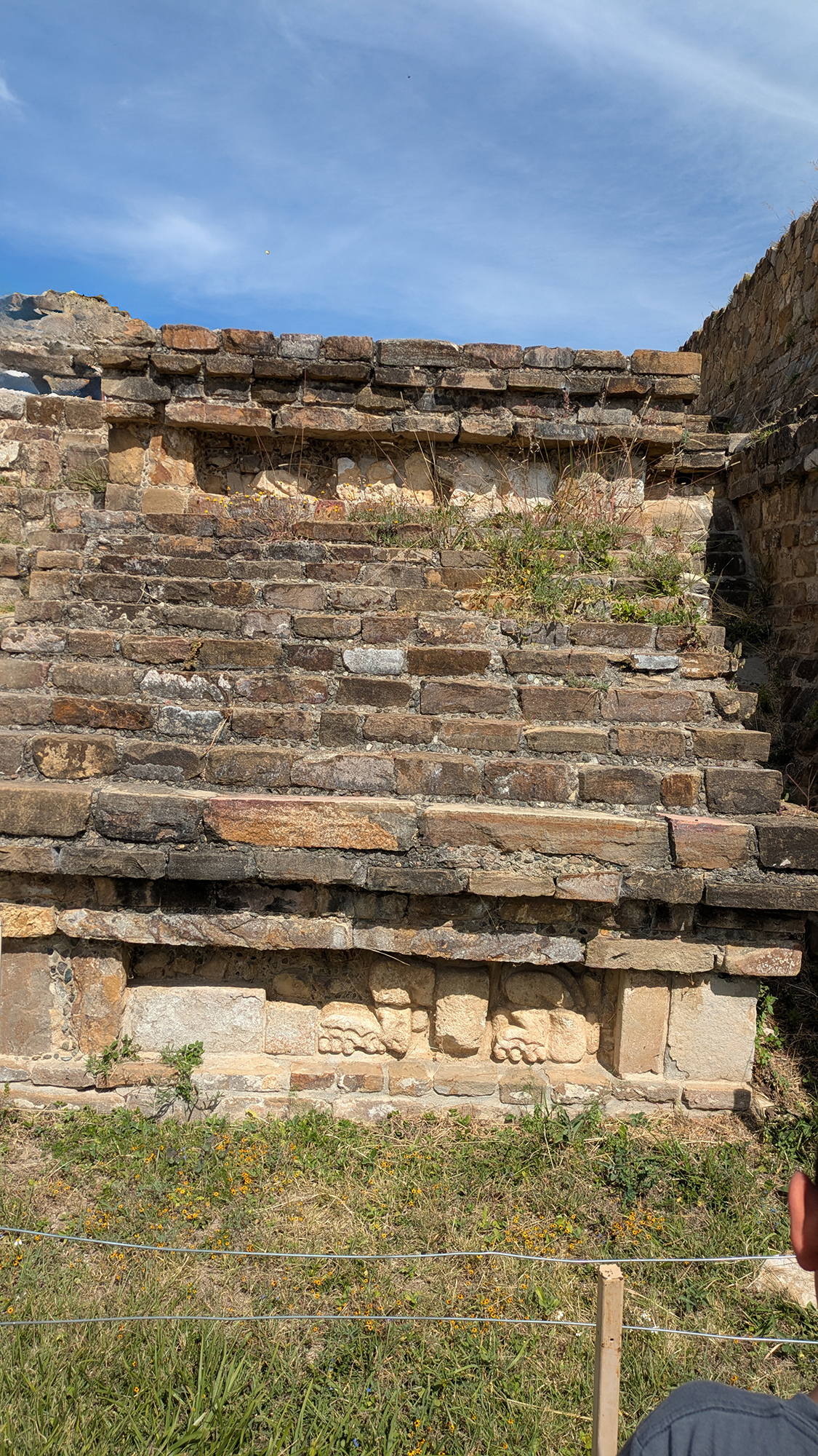
Monte Albán’s architecture is characterized by large stone platforms, broad stairways, patios, temples, elite residential complexes, and tombs integrated into domestic or lineage spheres. Part of its impact derives from its geometry, elevation, and structural mass. Buildings were arranged to dominate access points, frame ceremonies, restrict circulation, and control views toward the valley and across the plaza.⁴² A relevant feature of Zapotec architecture at Monte Albán is the use of the double-scapulary tablero. This element helps distinguish local styles from those of Teotihuacan, even when contact or influence existed between the two regions. Terracing was also a fundamental urban technology. Terraces made habitation possible on steep slopes, organized neighborhoods, and physically anchored the population to the mountain.¹¹² The Main Plaza was created through intensive labor, and the site as a whole required constant engineering: retaining walls, slope stabilization, drainage, and construction fill. Consequently, Monte Albán’s architecture cannot be reduced to temples alone. One of its most remarkable achievements was the comprehensive transformation of the terrain into an ordered urban world.⁴¹¹Urbanism and Social Organization
A central fact about Monte Albán is that most of its inhabitants did not live within the monumental core photographed by contemporary tourism. They lived on terraces along the site’s slopes and ridges. This forms a city of two components: a highly formalized civic-ceremonial center and an extended residential landscape spread across overlapping terraces.⁴ INAH descriptions emphasize that higher-status residences were concentrated closer to the monumental center, while lower-status households occupied peripheral terraced zones linked to agriculture, craft production, and daily subsistence. This spatial hierarchy is significant: it shows how status and location were closely connected. Living near the center was not merely convenient; it was political geography.¹² Residential complexes frequently included patios and funerary spaces, revealing the connection between domestic life, ancestor veneration, and lineage identity. Thus, the city was not only planned from the apex of power; it was also socially reproduced through households that lived, ritualized, buried, and remembered within its terraced fabric.¹⁵Economy, Tribute, and Daily Life
Monte Albán was the center of a regional economy based on agriculture, tribute, exchange, and craft production. INAH materials indicate that the city led a state that received goods such as maize, beans, and squash as tribute and participated in broader exchange networks through merchants and regional circulation. This means Monte Albán’s monumentality rested on concrete foundations: food, labor, logistics, and extraction.¹² Ceramic production was particularly important. The site is associated with fine urns and ritual imagery linked to powerful supernatural entities, such as rain and lightning deities. These objects were not merely decorative: they formed part of religious life, elite display, and, possibly, the symbolic economy of power.¹²⁵ The residential terraces of Greater Monte Albán also suggest agricultural integration with the surrounding lands and support systems beyond the ceremonial core. A city of this scale required sustained food production, material mobilization, and continuous infrastructure maintenance.Water Management and Landscape Engineering
Water management is one of the most undervalued aspects of Monte Albán. UNESCO explicitly highlights dams, canals, and other engineering features as part of the site’s significance. Its builders had to control runoff, stabilize slopes, and integrate drainage into a hilltop environment exposed to seasonal rains. Without this infrastructure, the monumental center and numerous residential terraces would have been highly vulnerable.²¹¹ Academic research has also emphasized springs, runoff channels, retaining systems, and hydraulic control on the mountain. This matters not only technically, but ideologically. In the Mesoamerican worldview, water, fertility, and sacred power were deeply intertwined. A city that mastered slopes and water did not simply solve engineering problems: it materialized cosmological order in stone and earth.¹⁷Sculpture, Writing, and Epigraphy
Monte Albán is a key location for the history of writing in the Americas. Carved stones, stelae, and slabs with glyphs indicate that the Zapotecs developed an early and enduring tradition of writing, calendrical notation, and public record. Javier Urcid’s work is fundamental for understanding this system and its historical development.⁷ The Danzantes are among the best-known monuments at the site. These reliefs depict human figures in contorted postures and have often been interpreted not as literal “dancers,” but as captives, sacrificed individuals, or politically charged representations related to domination, fertility, rulership, or ritual violence. Whatever the precise meaning of each figure, they belong to Monte Albán’s early monumental visual program and show that public stone sculpture was central to the city’s political language from its earliest stages.¹¹³ INAH also highlights the conquest slabs and stelae as part of the sculptural corpus, while the site museum identifies Stelae 12 and 13 among the early examples of Zapotec writing. The museum additionally presents a group of 32 carved stelae showing the evolution of writing; this constitutes a significant interpretive opportunity for this page and for the broader Wiki project.¹⁸Building J, Orientation, and Astronomy
Building J is one of the most unusual and debated structures at Monte Albán. Its arrowhead-shaped plan and distinctive orientation have led to astronomical interpretations, which is why it is frequently labeled an “observatory.” However, this term should be used with caution: a rigorous treatment should present the debate rather than convert it into definitive certainty.¹⁹²⁰ Anthony Aveni and Robert Linsley proposed that Building J’s orientation may relate to astronomical observations, including the Sun’s zenith passage and stellar events such as the rising of Capella. David Peeler later revisited the argument and published an important reassessment. The main point is not to “close” the issue, but to recognize that Monte Albán’s architecture was intentional, unique, and profound enough to sustain serious debate in archaeoastronomy.¹⁹²⁰ At the same time, Building J contains conquest inscriptions and must also be understood politically. Even if astronomical functions or symbolic alignments existed, the structure operated as a monument of state display. At Monte Albán, cosmology and government are rarely separate.Tombs, Murals, and Funerary Memory
The tombs of Monte Albán preserve crucial evidence concerning lineage identity, elite status, painted symbolism, and the relationship between the living and the dead. INAH currently records 249 documented tombs, presenting various architectural forms, including chamber tombs, cists, and associated funerary features.¹⁵ Many tombs were integrated into residential complexes, reinforcing the connection between household, ancestors, and status. Painted chambers such as Tomb 104 are particularly relevant to the study of ritual and iconography. For conservation reasons, not all tombs can remain open to the public.¹⁵ Funerary architecture also helps explain why Monte Albán remained significant after its political decline. Tombs were spaces of memory, prestige, and sacred continuity, making the city legible and reusable for later peoples, particularly the Mixtecs.¹⁵¹⁶Tomb 7 and Postclassic Mixtec Reuse
Tomb 7 remains one of the most famous archaeological discoveries in Mexico. On January 9, 1932, Alfonso Caso and his team entered the chamber and discovered an extraordinary range of offerings. Originally a Zapotec tomb, it was reused in the Postclassic period by the Mixtecs, whose objects gave the discovery international renown.¹⁶ The importance of Tomb 7 extends beyond its luxury objects of gold, jade, and bone. It proves that Monte Albán remained a place of ceremonial prestige well into the Postclassic period. A later group did not choose this space at random: they inserted themselves into an ancient sacred landscape, linking memory, legitimacy, and ancestors.¹⁶ Recent INAH research on the carved Bone 124 has expanded this story by proposing new readings related to dynastic alliances and Mixtec-Zapotec relations. This positions Tomb 7 not merely as an iconic twentieth-century discovery, but as an active field of interpretation in the twenty-first century.²¹Regional Interactions and Links with Teotihuacan
Monte Albán was not an isolated center. INAH notes that its relationship with Teotihuacan became especially significant between approximately 200 and 500 CE. Evidence has been identified for a Zapotec enclave or neighborhood at Teotihuacan, as well as Teotihuacan influences in ceramics and other materials linked to Oaxaca. This shows that Monte Albán participated in a broader Mesoamerican world of diplomacy, migration, exchange, and symbolic borrowing.¹² These interactions do not reduce Monte Albán to a passive recipient of external influences. The city maintained distinctive local traditions in architecture and writing while participating in long-distance networks. That balance between local identity and broad contact is part of its historical richness.Religion, Sacred Landscape, and Symbolism
Monte Albán was simultaneously a capital and a sacred landscape. Its elevated location, monumental stairways, platforms, tombs, carved monuments, and controlled views contributed to an environment in which political authority was inseparable from ritual authority. The city was designed to stage the sacred in public space.²³ Religious symbolism also appears in funerary contexts, in urn iconography, and in the integration of architecture with a cosmic and geographic order. The position above the valley offered elites a stage on which to articulate mountain, ancestors, sky, rain, fertility, and sovereignty. Monte Albán was sacred not simply because it stood on a summit, but because the summit was rebuilt as a theater of ritual power.Archaeological Research and Modern Studies
Modern archaeology at Monte Albán began systematically with Alfonso Caso in the early 1930s. His excavations, ceramic sequences, and documentation of elite tombs, particularly Tomb 7, established the foundation for subsequent research.⁵¹⁶ Later, other researchers decisively expanded the picture. Kent Flannery and Joyce Marcus reformulated the understanding of Monte Albán’s origins by placing it within the long-term development of the Valley of Oaxaca and connecting its foundation to broader questions of urbanism and state formation. Richard Blanton’s settlement-pattern survey revealed the true spatial scale of the city, mapping terraces and residential distribution across the expanded site far beyond the central plaza.¹⁴⁹ More recent investigations, including geophysical studies, conservation initiatives, and new epigraphic readings, continue to revise and enrich our understanding of the site. Monte Albán is not a “closed” archaeological case; it continues to generate questions and evidence.¹⁰²¹Site Museum
The Monte Albán Site Museum is essential for understanding the ruins. According to INAH, the museum opened in November 1994, covers approximately 1,200 square meters, and presents around 650 archaeological pieces. Its galleries address the foundation of the site, architecture, ceramics, religion, funerary practices, writing, exchange, and collapse.¹⁸ This is especially important for visitors, since some of the finest and most fragile materials are better understood in a museum setting than outdoors. The museum also helps close a common gap: admiration for architecture is not always accompanied by an understanding of writing, sculpture, funerary iconography, and the interpretive work required to explain the site.Key Features of the Site
- Main Plaza: A large central esplanade, artificially leveled and framed by the principal ceremonial and political structures.
- North Platform: One of the most imposing sectors, associated with elite complexes, patios, and commanding views.
- South Platform: The monumental southern end of the plaza and a key anchor of the ceremonial composition.
- Building J: A structure with an unusual orientation, associated with conquest slabs and sustained astronomical debate.
- Gallery of the Danzantes: Early reliefs central to the site’s visual and political history.
- Ballcourt: An I-shaped ritual court that articulated sport, ceremony, politics, and elite display.
- Central Buildings G, H, and I: Core structures that organize movement and sightlines within the ceremonial precinct.
- Tombs: Elite funerary chambers, many with painted or carved decoration, fundamental to lineage memory.
- Tomb 7: A Zapotec tomb reused by the Mixtecs, famous as one of the richest discoveries in Mexican archaeology.
- Residential Terraces: The urban fabric of Greater Monte Albán, where much of the population lived.
Conservation, Protection, and Current Threats
Monte Albán is protected heritage and, at the same time, a site under pressure. Recent UNESCO documentation emphasizes the integrity and authenticity of the property, but also identifies real management concerns, especially regarding urban expansion around the protected area and buffer zone. This is not a minor administrative detail: it is the site’s present reality.¹¹ The same documentation addresses resource limitations, capacity challenges, and management needs. A definitive page should not present Monte Albán as a static and perfect object, but explain that its preservation requires institutions, budgets, specialized personnel, visitor management, and public support.¹¹ The World Monuments Fund has also highlighted conservation issues and the scale of the site’s landscape, reinforcing the need to think beyond the “postcard” view of the Main Plaza. Monte Albán is a landscape, not a single monument.¹⁰Visitor Notes
According to official INAH records, Monte Albán is open daily from 08:00 to 17:00, with last entry at 16:00. Admission is registered under Category I, with a general price of 210 MXN and a reduced rate of 105 MXN for visitors who meet specific criteria. Visitors are advised to verify fees before arriving, since official charges are subject to change.⁶ INAH also notes relevant restrictions: food is prohibited inside the archaeological zone, pets are not permitted, and smoking is forbidden.⁶ The terrain is uneven, sunny, and physically demanding in certain sectors. Appropriate footwear, hydration before entry, sun protection, and a realistic pace are strongly recommended. The site museum is especially recommended for those seeking to understand the historical and material context of the archaeological complex. Note for visitors relying on public transportation: the last departure from the ruins back to the city is at 2:30 PM.Why Monte Albán Matters Today
Monte Albán remains essential because it brings together the major themes of Mesoamerican history in a single location: early urbanism, state formation, public writing, sacred geography, elite burial, long-distance interaction, political symbolism, and later cultural reuse. It is a site that invites interpretation through architecture, archaeology, history, epigraphy, religion, and heritage management. For Oaxaca, Monte Albán is more than a tourist destination: it is a foundational place for understanding the political and cultural development of the valley in antiquity. For global history, it constitutes one of the clearest examples of how societies transformed landscape into ideology and stone into government.Academic References and Primary Sources
- Marcus, Joyce, and Kent V. Flannery. (1996). Zapotec Civilization: How Urban Society Evolved in Mexico's Valley of Oaxaca. Thames & Hudson.
- UNESCO World Heritage Centre. "Historic Centre of Oaxaca and Archaeological Site of Monte Albán."
- Metropolitan Museum of Art. "Monte Albán: Sacred Architecture." Heilbrunn Timeline of Art History.
- Blanton, Richard E. (1978). Monte Albán: Settlement Patterns at the Ancient Zapotec Capital. Academic Press.
- Caso, Alfonso, Ignacio Bernal, and Jorge R. Acosta. (1967). La Cerámica de Monte Albán. INAH.
- INAH. "Monte Albán: Official Visitor Information."
- Urcid, Javier. (2001). Zapotec Hieroglyphic Writing. Dumbarton Oaks.
- Blanton, Richard E., Stephen A. Kowalewski, Gary M. Feinman, and Jill Appel. (1982). Monte Albán's Hinterland, Part I: Prehispanic Settlement Patterns of the Central and Southern Parts of the Valley of Oaxaca, Mexico. University of Michigan Museum of Anthropology.
- Flannery, Kent V., and Joyce Marcus. (2015). Excavations at San José Mogote. University of Michigan Museum of Anthropology.
- World Monuments Fund. "Monte Albán."
- UNESCO World Heritage Centre. Periodic Reporting, Section II, Property 415: Historic Centre of Oaxaca and Archaeological Site of Monte Albán.
- INAH. Monte Albán: Institutional Descriptive Guide and Historical Synthesis.
- INAH. "The Danzantes of Monte Albán."
- INAH and related academic syntheses on population estimates of approximately 35,000 inhabitants.
- INAH. "The Tombs of Monte Albán."
- INAH. "Carved Bone from Tomb 7."
- Specialized academic works on water management and sacred landscape engineering at Monte Albán and in the Valley of Oaxaca.
- INAH. "Monte Albán Site Museum."
- Aveni, Anthony F., and Robert M. Linsley. (1972). "Mound J, Monte Albán: Possible Astronomical Orientation." American Antiquity.
- Peeler, David A. (1995). "Building J at Monte Albán: A Correction and Reassessment of the Astronomical Hypothesis." Latin American Antiquity.
- INAH. "Reading of Bone 124 from Tomb 7 of Monte Albán Reiterates Dynastic Alliances between Mixtec and Zapotec Kingdoms."